

giKomunal
Municipal asset registers for towns and municipalities
giKomunal is a giGIS module for towns and municipalities: it keeps statutory registers of municipal assets on a map instead of in Excel sheets, with a traceable history of every change and roles tailored to local government workflows.
Status:Prototype in development — a pilot with test data in preparation.
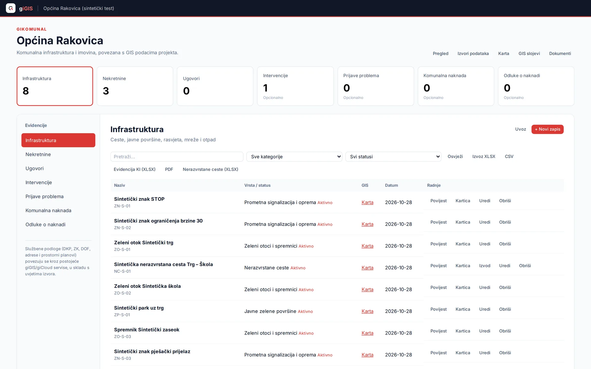
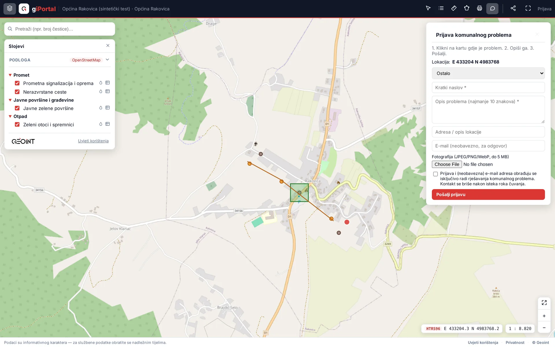
Screenshots show synthetic test data.
Registers on the map
Asset and infrastructure registers — green areas, municipal facilities, equipment — are linked to one or more geometries on the map. The record is edited in its card, the geometry on the map, and everything stays connected.
Traceability of changes
- Change history without deletion: records are archived, never erased
- Append-only history enforced at the database level
- Every change is permanently recorded — who, what and when
Roles for local government
- Administrator: municipality setup, users and permissions
- Staff: maintaining registers and field work
- Review: read-only access for oversight without edits
- Access is granted per project and per layer
Citizens
A public municipal page with a map and problem reporting — a citizen marks the location, adds a photo and a description, no registration needed. Reporting is an optional module enabled in agreement with the municipality. A mobile app for citizen reports is planned.
Basemaps through giCloud
Official basemaps (orthophoto, cadastre, topographic maps) and OSM layers come through giCloud as managed layers — the municipality does not have to run its own basemap infrastructure.
Honest about the status
giKomunal is a prototype in development; a pilot is being prepared on a synthetic municipality built from public sources. Utility fee calculation exists as a specification awaiting legal review — the system does not issue administrative decisions and does not claim integrations with state systems that have not been built.
Interested in a pilot or a demo?
The products are in development and we are looking for early users. Get in touch and we will set up a walkthrough on your data.
Contact us