

giCloud
Croatian spatial basemaps through a single API
giCloud solves a problem every Croatian GIS project runs into: how to serve public basemaps quickly and reliably — without overloading the upstream services and without juggling multiple URLs and terms of use.
Status:In active development — powers basemaps for giGIS and giKomunal.
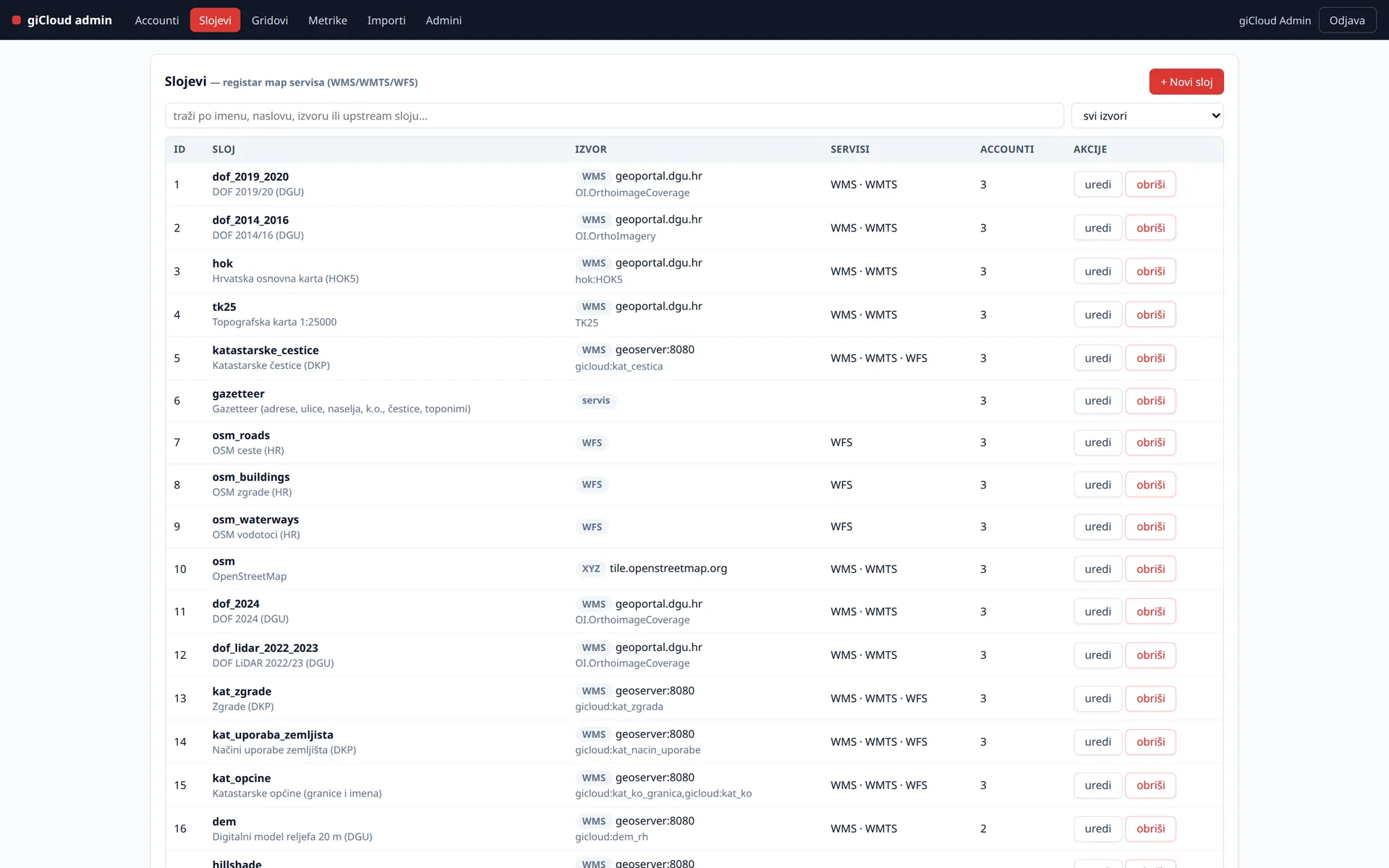
Screenshots show synthetic test data.
One catalogue of sources
Public Croatian sources in one place: state geodetic basemaps (orthophoto, topographic maps, the Croatian base map), cadastre, OSM layers (roads, buildings), the national planning system ISPU and a digital elevation model — and other WMS, WFS and XYZ sources can be added to the catalogue.
Fast serving
- A tile cache stored in S3/MinIO — maps get ready-made tiles instead of hitting the upstream service on every request
- A tile grid aligned with the Croatian state WMTS gridset in EPSG:3765 (HTRS96)
- Web mercator (EPSG:3857) support for global web maps
- Offloads public services and keeps performance stable regardless of the source
Access and usage control
- Access tokens per account and entitlements per service
- Spatial extents — an account only sees its own area
- Rate limits and usage metering per account
OGC compatibility
WMS, WMTS and WFS endpoints work from QGIS and any OGC client — one token instead of configuring a series of services. giGIS and giKomunal add basemaps as managed layers through the same API.
Gazetteer and analytics
- Search across addresses, streets, settlements, cadastral municipalities and parcels
- Automated source synchronisation (state geodetic ATOM services)
- Satellite analytics on Sentinel-1 and Sentinel-2 imagery (zonal statistics) — in development, enabled on request
Technology
FastAPI, PostGIS, MapProxy, MinIO, Celery and GeoServer — proven open-source tools, no vendor lock-in.
Interested in a pilot or a demo?
The products are in development and we are looking for early users. Get in touch and we will set up a walkthrough on your data.
Contact us